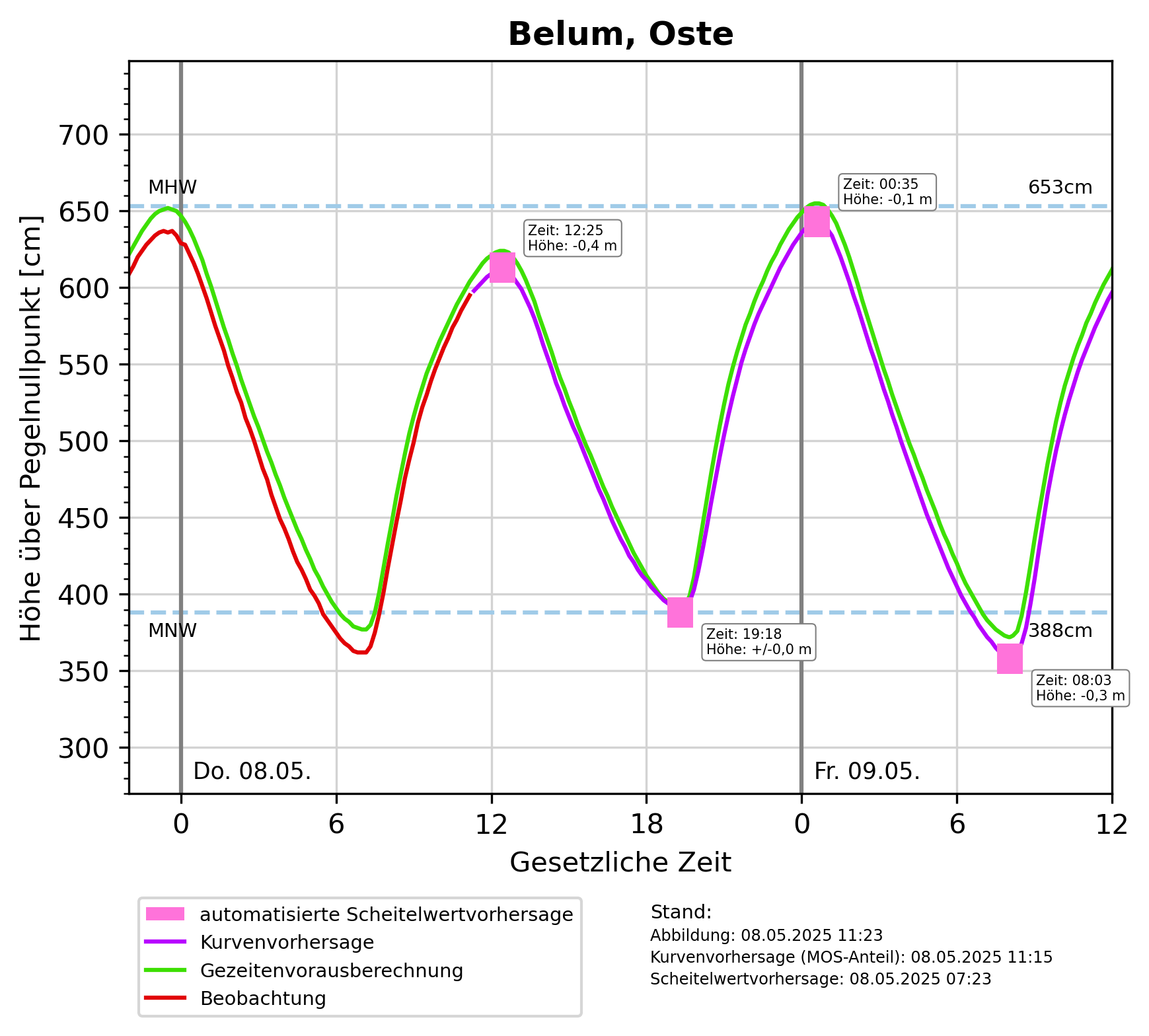
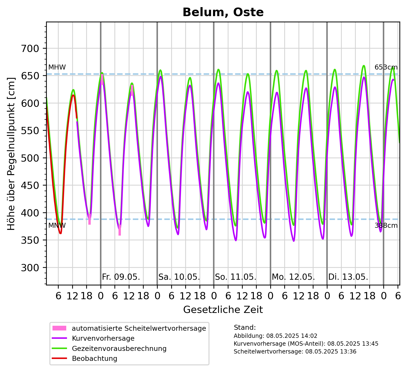
Description: Mittleres Hochwasser (MHW): 6m über Pegelnullpunkt, Mittleres Niedrigwasser (MNW): 3m über Pegelnullpunkt
DataMeasurements(
    DataMeasurements {
        domain: Water(
            Sea,
        ),
        station: Some(
            Station {
                id: Some(
                    "Belum, Oste",
                ),
                measurement_frequency: None,
                reporting_obligations: [],
            },
        ),
        measured_variables: [
            "Wasserstand",
        ],
        methods: [],
    },
)
Origins: /Bund/BSH/Sturmflutwarndienst
Tags: Hochwasser ? Wasserstandsvorhersage ? Oste ? Niedrigwasser ? Meeresgewässer ? Wasser ? Wasserstand ? Nordsee ?
Region: Elbe
Bounding boxes: 9.037222° .. 9.037222° x 53.822778° .. 53.822778° 10.28333° .. 10.28333° x 52.08333° .. 52.08333°
License: all-rights-reserved
Language: Deutsch
Modified: 2025-12-12
Time ranges: 2025-12-12 - 2025-12-12
Aktuelle Messdaten über PEGELONLINE
https://www.pegelonline.wsv.de/webservices/zeitreihe/visualisierung?ansicht=einzeln&pegeluuid=a9e93be0-cb0e-4418-ba3c-94e7869f6199 (Webseite) *Diagram für Vorhersagen für Tag_1-2: Höhe über pegelnullpunkt [cm]
https://www.sturmflutwarndienst.de/ersatzgrafik/DE__683P_Tag_1-2_PNP.png (PNG)Diagram für Vorhersagen für Tag_1-6: Höhe über pegelnullpunkt [cm]
https://www.sturmflutwarndienst.de/ersatzgrafik/DE__683P_Tag_1-6_PNP.png (PNG)Accessed 1 times.