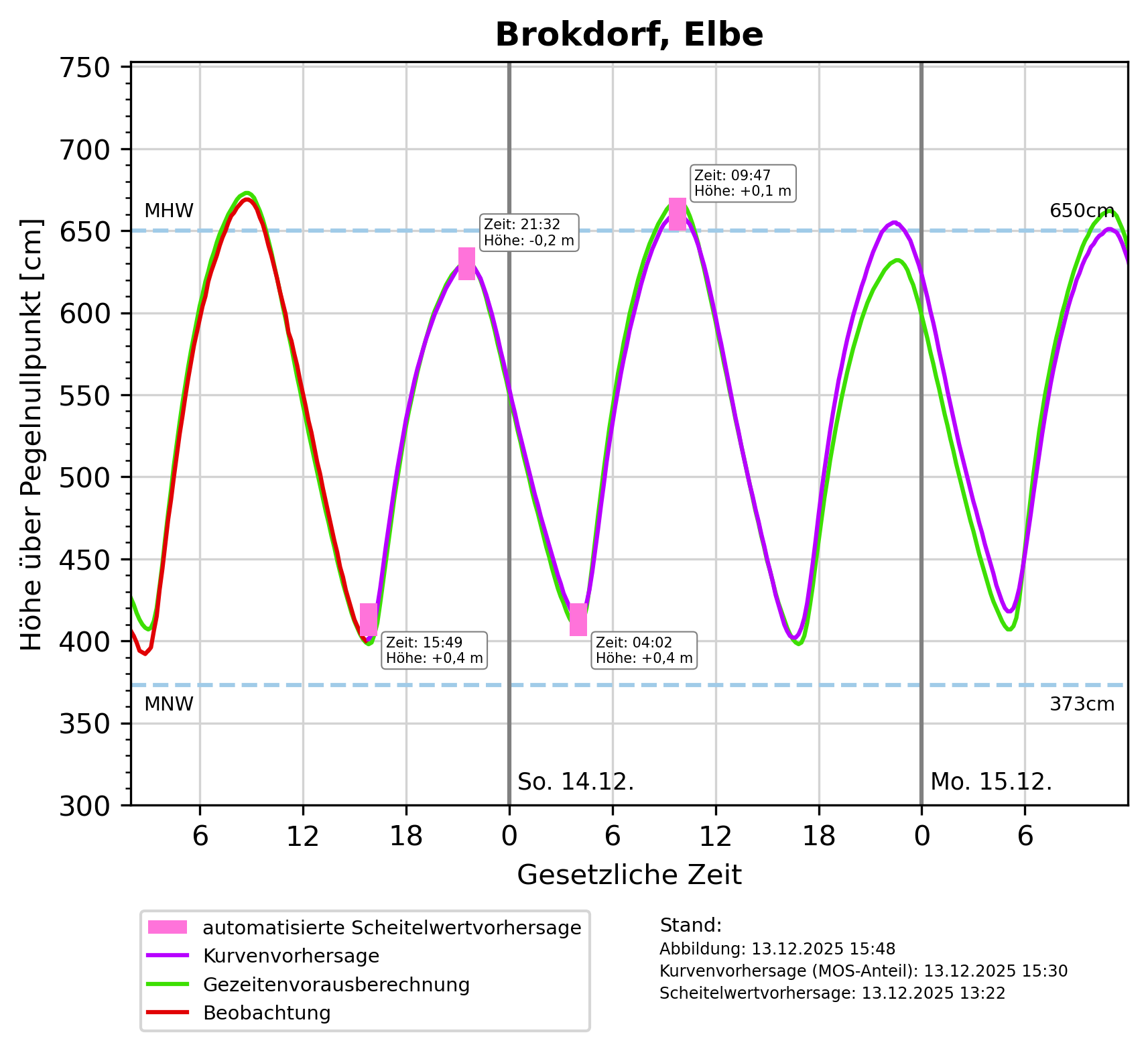
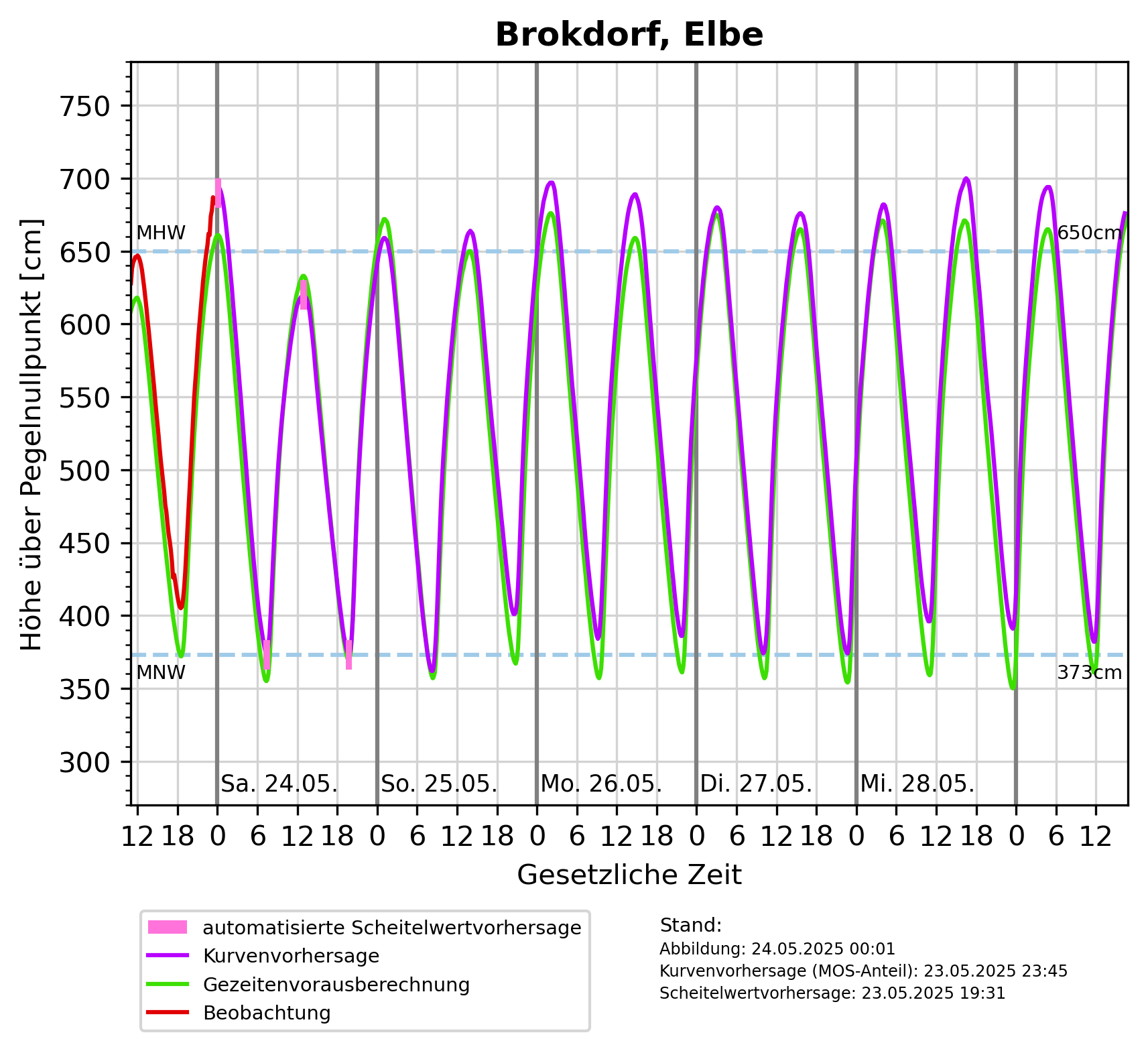
Description: Mittleres Hochwasser (MHW): 6m über Pegelnullpunkt, Mittleres Niedrigwasser (MNW): 3m über Pegelnullpunkt
DataMeasurements(
    DataMeasurements {
        domain: Water(
            Sea,
        ),
        station: Some(
            Station {
                id: Some(
                    "Brokdorf, Elbe",
                ),
                measurement_frequency: None,
                reporting_obligations: [],
            },
        ),
        measured_variables: [
            "Wasserstand",
        ],
        methods: [],
    },
)
Tags: Brokdorf ? Hochwasser ? Elbe ? Wasserstandsvorhersage ? Niedrigwasser ? Meeresgewässer ? Wasser ? Wasserstand ? Nordsee ?
Region: Elbe-Lübeck-Kanal
Bounding boxes: 9.316111° .. 9.316111° x 53.862778° .. 53.862778° 10.55844° .. 10.55844° x 53.36987° .. 53.36987°
License: Alle Rechte vorbehalten
Language: Deutsch
Modified: 2026-05-26
Last harvest: 26.05.2026 23:16
Time ranges: 2026-05-26 - 2026-06-01
Aktuelle Messdaten über PEGELONLINE
https://www.pegelonline.wsv.de/webservices/zeitreihe/visualisierung?ansicht=einzeln&pegeluuid=610ab204-d3c4-4a11-a38b-e31461fdcf27 (Webseite) * ✓Diagram für Vorhersagen für Tag_1-2: Höhe über pegelnullpunkt [cm]
https://www.sturmflutwarndienst.de/ersatzgrafik/DE__688P_Tag_1-2_PNP.png (PNG) ✓Diagram für Vorhersagen für Tag_1-6: Höhe über pegelnullpunkt [cm]
https://www.sturmflutwarndienst.de/ersatzgrafik/DE__688P_Tag_1-6_PNP.png (PNG) ✓Accessed 1 times.