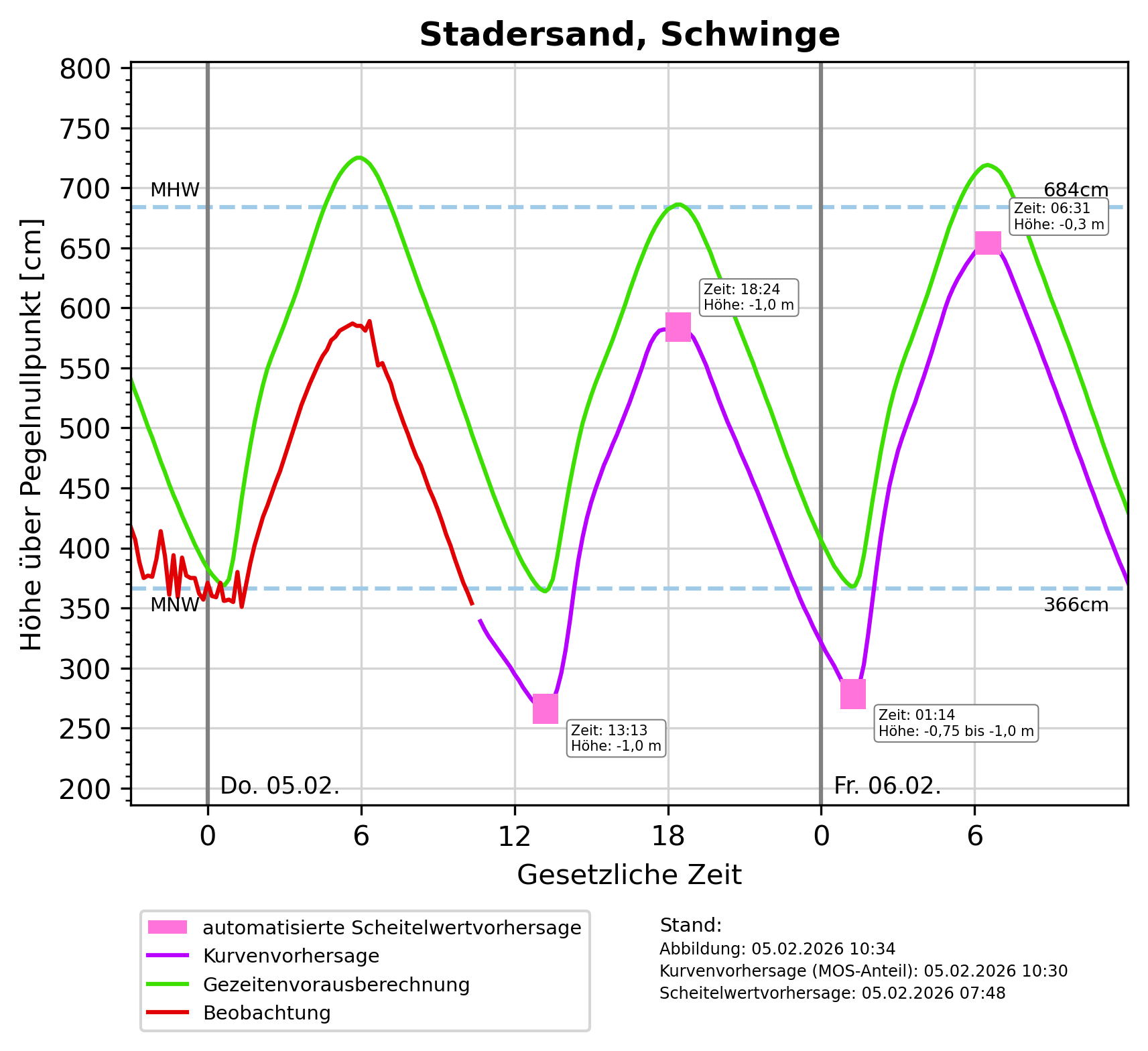
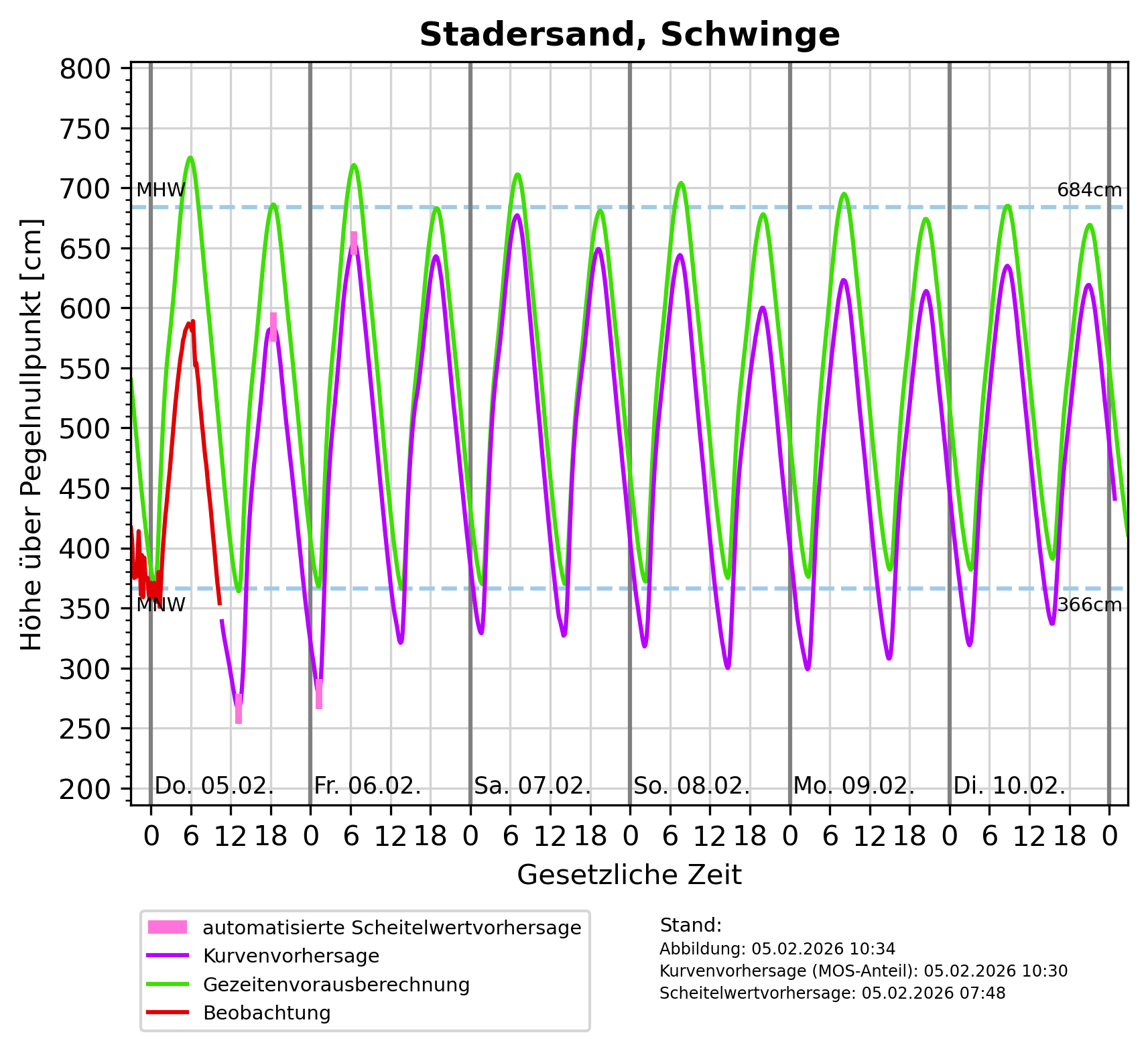
Description: Mittleres Hochwasser (MHW): 6m über Pegelnullpunkt, Mittleres Niedrigwasser (MNW): 3m über Pegelnullpunkt
DataMeasurements(
    DataMeasurements {
        domain: Water(
            Sea,
        ),
        station: Some(
            Station {
                id: Some(
                    "Stadersand, Schwinge",
                ),
                measurement_frequency: None,
                reporting_obligations: [],
            },
        ),
        measured_variables: [
            "Wasserstand",
        ],
        methods: [],
    },
)
Tags: Hochwasser ? Wasserstandsvorhersage ? Niedrigwasser ? Meeresgewässer ? Wasser ? Wasserstand ? Nordsee ?
Region: Elbe
Bounding boxes: 9.526667° .. 9.526667° x 53.629722° .. 53.629722° 10.235950589345814° .. 10.325036945330726° x 52.06299603842° .. 52.10748536026503°
License: Alle Rechte vorbehalten
Language: Deutsch
Modified: 2026-05-14
Last harvest: 14.05.2026 23:11
Time ranges: 2026-05-14 - 2026-05-20
Aktuelle Messdaten über PEGELONLINE
https://www.pegelonline.wsv.de/webservices/zeitreihe/visualisierung?ansicht=einzeln&pegeluuid=80f0fc4d-9fc7-449d-9d68-ee89333f0eff (Webseite) *Diagram für Vorhersagen für Tag_1-2: Höhe über pegelnullpunkt [cm]
https://www.sturmflutwarndienst.de/ersatzgrafik/DE__709P_Tag_1-2_PNP.png (PNG)Diagram für Vorhersagen für Tag_1-6: Höhe über pegelnullpunkt [cm]
https://www.sturmflutwarndienst.de/ersatzgrafik/DE__709P_Tag_1-6_PNP.png (PNG)Accessed 1 times.